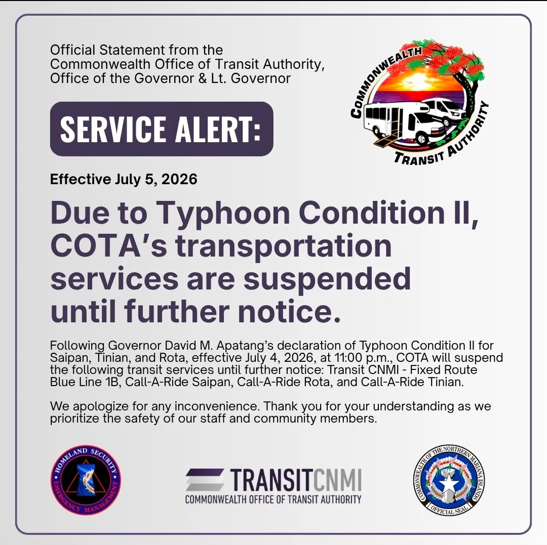


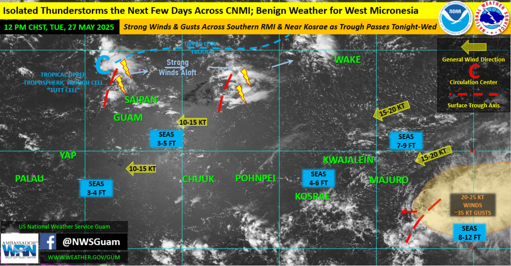

THE CNMI will experience isolated thunderstorms in the next few days, according to the National Weather Service-Guam’s weekly regional outlook issued on May 27.
“We continue to see thunderstorms across the CNMI periodically developing in response to favorable upper-level conditions that will linger for another couple of days,” said William Brandon Aydlett, NWS-Guam acting meteorologist-in-charge and science & operations officer.
“Southeast of Majuro, we’ll be watching a quick-moving surface trough slide west. Strong, gusty winds associated with the trough will affect the southernmost atolls and islands of the Republic of the Marshall Islands and possibly Kosrae between [Tuesday evening] and Wednesday night. In response to the winds, expect quick spikes in sea conditions, especially the short-period waves.”
According to the NWS regional overview, quiet conditions have returned for much of central and western Micronesia and the lower Marianas with gentle to moderate winds. Light winds at times could promote some daytime island-effect showers and/or thunderstorms near Palau and Guam, but only when surface winds have fallen below 10 mph, the NWS stated.
The tropical upper-tropospheric trough remains perched across the far northern Marianas and has helped to spark thunderstorms off-and-on the past several days. This will continue through Wednesday-Thursday, the NWS added.
“Well to the southeast, a westward-moving surface trough and a broad area of cloudiness, showers and thunderstorms are moving toward the far southern Marshall Islands. Midday satellite-derived surface wind data show 20-25 [knot] winds, likely guaranteeing much stronger gusts, as has been depicted in some model data the past few days. As this system moves west, stronger northeast winds will spread across the southern Marshall Islands. While models keep the strongest winds passing just south of the atolls, local seas (south of Majuro) will likely see a quick spike of short-period waves in response to the stronger winds and gusts.”
Additionally, with the new moon and resulting higher high tides (and lower low tides), increased erosion and shoreline wave run-up will be possible, the NWS added.