


By Walter Ulloa
For Variety
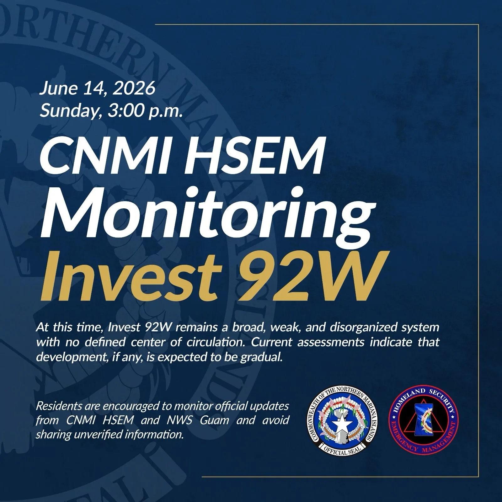
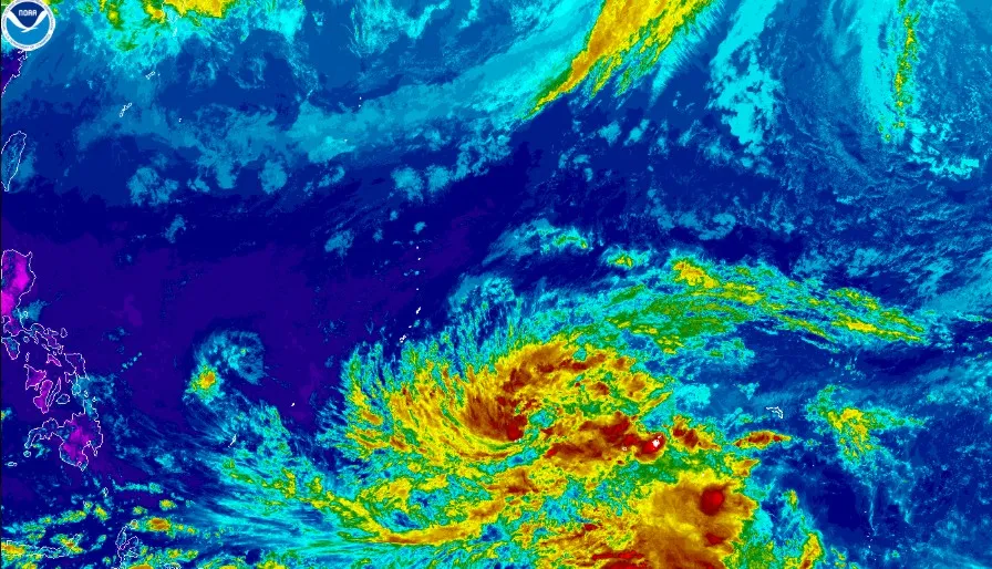
HAGÅTÑA (The Guam Daily Post) — Invest Area 90W is organizing faster than expected, and forecasters say a tropical depression could be declared as early as Thursday afternoon as the system tracks toward the Marianas.
Brandon Aydlett, science and operations officer at the NWS Weather Forecast Office Guam, said Thursday morning the Joint Typhoon Warning Center issued a tropical cyclone formation alert, signaling a formal tropical depression warning is likely within 24 hours.
“They’ll probably warn on a tropical depression and label it a tropical depression within the next 24 hours,” Aydlett told The Guam Daily Post. “So perhaps this afternoon or as late as tomorrow morning, but I would expect to see a tropical depression out of the system pretty soon.”
The more likely track now shows the system passing south of Guam late Sunday night into early Monday, a shift from the wider range of possibilities forecasters were weighing just 24 hours earlier.
“I would not have been ready to admit that yesterday,” Aydlett said. “There’s too much variability in the models, but today we’re seeing a much better signal that suggests a passage to our south, though a passage closer to us is still not out of the question.”
Once the system is formally designated a tropical depression, the NWS will issue public advisories every six hours, beginning at 2 p.m. or 8 p.m. on Thursday, along with forecast track graphics.
Residents can expect fairly pleasant conditions through Saturday, with breezy trade winds and passing showers. Heavier weather is expected late in the weekend.
“It’s not until Sunday night that we will probably see the more direct impacts of 90W intensifying and passing just south of us,” Aydlett said.
How strong those impacts will be depends largely on how close the center comes to the island.
“The closer you are to the center of a tropical cyclone, the winds and the rainfall are much more intense,” he said. “The proximity is going to be the key determinant on how strong our wind conditions will be, and especially the rainfall potential and the flood threat.”
The system could intensify into a typhoon somewhere south or southwest of Guam around Monday. A worst-case northward shift bringing stronger winds and heavier rain directly over Guam remains possible.
“I think over the next 24 hours, we’re going to continue to get a clearer picture in the modeling, and that’s going to really help fine-tune some of those numbers,” Aydlett said.
The Guam Homeland Security/Office of Civil Defense, citing NWS guidance, said the Marianas can expect increasing showers, thunderstorms and gusty winds developing late Saturday, with the heaviest rain and possible onset of damaging winds of 39 mph anticipated Sunday night into early Tuesday.
GHS/OCD is advising residents to clear drainage areas and storm drains, secure loose outdoor items and prepare an emergency kit with seven to 10 days of food, water, medication and important documents.
Active advisories as of Thursday morning include a high risk of rip currents for Guam, Rota, Tinian and Saipan through Friday afternoon, and a small craft advisory for coastal waters of the same islands through 4 p.m. Friday.
The Guam Power Authority is also urging the public to check their property for damaged trees and overhanging branches, secure lightweight outdoor items that could become airborne and unplug sensitive electronics before the weather worsens. GPA also cautioned against connecting generators directly into household wiring, noting the only safe method is through a transfer switch installed by a qualified electrician.
Residents should stay current by monitoring weather.gov/gum and following NWS Guam and GHS/OCD on social media for the latest advisories and track updates.