


HAGÅTÑA (The Guam Daily Post) — While Typhoon Mawar was one of the strongest to strike the island in 20 years, wielding devastating power that uprooted trees and tore apart homes, it wasn’t quite as strong as a few other typhoons that Guam experienced in the past, according to local weather officials.
Speaking during the Typhoon Mawar assessment press conference on Friday, Chip Guard, the former warning coordination meteorologist at the National Weather Service Guam, said they determined that Mawar was a little weaker than Typhoon Pongsona, which battered the island in late 2002, and Typhoon Paka, which struck in 1997.
“(Mawar) is somewhere between a (Typhoon) Omar and (Typhoon) Pamela kind of intensity,” Guard said.
Omar and Pamela devastated Guam in 1992 and 1976, respectively.
While not the strongest typhoon to impact Guam, Mawar was a Category 4 typhoon by the time it passed the island between May 24 and 25. As the storm approached, it had weakened from super typhoon to a still-powerful Category 4 typhoon with maximum sustained winds of 140 mph.
A post-storm reassessment by the Joint Typhoon Warning Center lowered the overall intensity to a 130 mph Category 4 typhoon at Mawar’s closest point of approach, which was around 5-8 p.m. on May 24.
Within 24 hours of pulling away from Guam, Mawar had ramped up to a Category 5 super typhoon with maximum sustained winds of 185 mph.
Acting Guam Homeland Security Advisor Esther Aguigui said at the Friday briefing that the takeaway from Mawar is Guam always has to be ready.
“This is another illustration that we’ve grown some atrophy in the last 20 years because we didn’t have to deal with a storm of this magnitude. But this was an awakening call — a call to duty for all of us who are first responders,” Aguigui said.
She said Homeland has a comprehensive emergency management plan, which describes what residents might need to know about being ready.
Office of Civil Defense Administrator Charles Esteves said the last time Guam received individual assistance from the Federal Emergency Management Agency, prior to Mawar, was Pongsona, despite the number of storms and disaster declarations over the year since then.
“That’s really indicative of the impact that a storm of this magnitude had toward the island,” Esteves said. “One of the key differences is the amount of mitigation efforts taken over the last couple decades. … A lot of it is also the actions taken by individual household owners — the transition from semi-permanent to full-pour concrete houses, the money used during Pongsona to harden your property, if you didn’t have insurance, getting insurance.”
Eye over Andersen
The power of the storm wasn’t felt evenly throughout the island, however.
Damage and impact varied from north to south. Villages in the north were closest to the center of the storm and suffered the most intense winds and most significant damage. Maximum sustained winds slowed down farther south, where residents still experienced typhoon-force winds but less damage overall.
As Guard noted at Friday’s assessment briefing, Guam is a 30-mile long island but still saw a wide array of wind speeds, ranging from the severe tropical storm category to the subcategory of high-end Category 4 winds.
“You can see how tightly packed these winds are,” Guard said.
Mawar went through the Rota Channel, but part of the eye of the storm did pass over Andersen Air Force Base. It lasted about 20 minutes, according to Guard.
“When Pongonsa came through, Andersen Air Force Base had an eye passage of two and a half hours. So that means the wall cloud was a lot farther south, (and) did a lot more damage,” Guard said.
Damage suggests there was the equivalent of super typhoon force winds at some portions of Guam, NWS Science and Operations Officer Brandon Aydlett said Friday. It was the north-western tip of the island that saw the strongest winds.
“There’s a naval communications station up there. (Marine Corps Base) Camp Blaz is up there. And it’s getting down close to the Astumbo area and Fern Terrace,” Guard said. “So, there’s a gradient of damage that we can ascertain.”
Potential storms ahead
Officials have warned that Guam and the Commonwealth of the Northern Mariana Islands could face two or three major typhoons before the end of the year.
Aydlett said NWS Guam is in close communication with the Joint Typhoon Warning Center, which produces forecast tracks, whenever there is a potential threat. While the center has a large area of responsibility, including the South Pacific and the Indian Ocean, they all are looking for any disturbance posing a threat, Aydlett said.
“So, several weeks in advance, we can see when a pattern could become more favorable for a tropical cyclone. Then, as we get closer in to a disturbance actually starting take shape, we’re on the phone with (the center) almost daily comparing notes,” Aydlett said.
As something becomes more substantial, NWS Chief Meteorologist Landon Aydlett would be on the phone with the Guam Emergency Operations Center talking about the potential threat, Brandon Aydlett added.

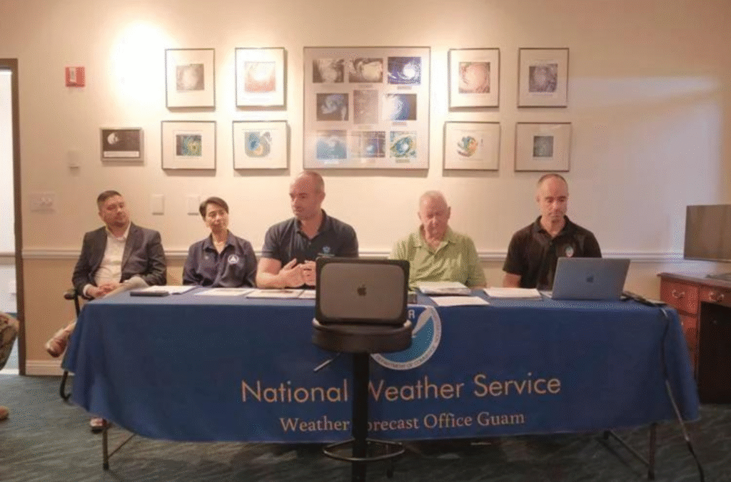
Representatives from the National Weather Service and Guam Homeland Security/Office of Civil Defense hold a meeting for a Typhoon Mawar assessment at the NWS office in Tiyan, Barrigada, on Friday. Pictured from left: GHS/OCD Administrator Charles Esteves; acting Guam Homeland Security Advisor Esther Aguigui; NWS warning coordination meteorologist Landon Aydlett; Charles “Chip” Guard, former NWS warning coordination meteorologist and Brandon Aydlett, NWS meteorologist.

Charles “Chip” Guard, former National Weather Service warning coordination meteorologist, assesses Typhoon Mawar during a meeting at the National Weather Service office in Tiyan, Barrigada, on Friday, July 14, 2023.
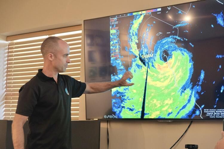
Meteorologist Brandon Aydlett of the National Weather Service gives an assessment on Typhoon Mawar during a meeting at the National Weather Service office in Tiyan, Barrigada, on Friday.