


Tropical Storm Krosa (12W)
Bulletin #10
Date: July 26, 2025
Time: 2:00 PM
Based on information received from the National Weather Service-Tiyan Guam and compiled at the CNMI Emergency Operations Center-State Warning Point:
…Tropical Storm Krosa nearly stationary…
Changes with this advisory
None.
Watches and warnings
A tropical storm warning remains in effect for Alamagan, Pagan, and Agrihan.
A tropical storm warning means that tropical storm conditions, including winds of 39 to 73 mph, are occurring or imminent.
Summary of 1:00 PM CHST…0300 UTC…information
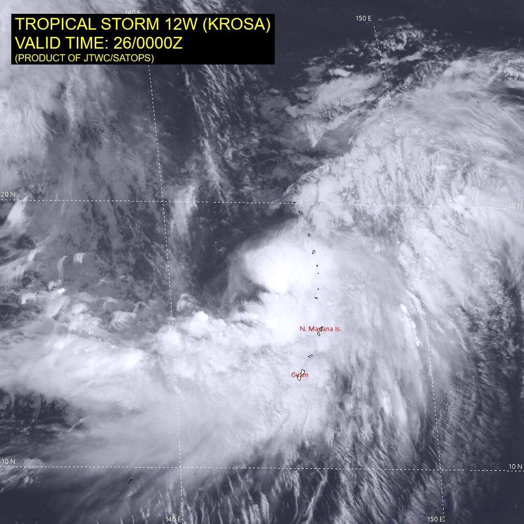
Location: 18.1N 143.9E
- About 125 miles west of Pagan
- About 125 miles west-southwest of Agrihan
- About 130 miles west-northwest of Alamagan
- About 165 miles northwest of Anatahan
- About 240 miles north-northwest of Saipan
- Maximum sustained winds: 60 mph
Present movement: east-northeast, 70 degrees at 3 mph
Discussion and outlook
At 1:00 PM CHST…0300 UTC…the center of Tropical Storm Krosa was located near latitude 18.1 degrees north and longitude 143.9 degrees east. Krosa is moving east-northeast at 3 mph. It is expected to make a turn toward the north-northeast with an increase in forward speed through Sunday.
Maximum sustained winds have increased to 60 mph. Krosa is forecast to maintain this intensity through Sunday afternoon, then begin to slowly strengthen.
Tropical storm force winds extend outward from the center up to 230 miles to the south and up to 115 miles to the north.
As Tropical Storm Krosa (12W) still poses a threat to Agrihan, Alamagan, and Pagan, Governor David M. Apatang has issued the following conditions as of 2:00 PM:
Maintained: Tropical storm condition I: Agrihan, Alamagan, and Pagan
*Tropical storm condition I means that tropical storm force winds are expected within 12 hours or occurring.
Please remain cautious as hazardous weather conditions persist. Active advisories are still in effect for Saipan, Tinian, and Rota including small craft, high surf, rip current, flood watch, and wind advisories.
The CNMI Emergency Operations Center State Warning Point will be monitoring the movement of Tropical Storm Krosa (12W) and will be issuing out bulletins as they become available. Keep a close watch on updates to weather forecasts and stay informed on the latest statements and advisories, which will be available through local media sources and NOAA Weather Radio broadcast via phone at 211, or call CNMI EOC State Warning Point at 237-8000 or 664-8000. For the Northern Islands, contact CNMI EOC State Warning Point at high frequency single side band radio on frequency 5.205.0.
An intermediate bulletin will be issued at 5:00 PM CHST followed by the next scheduled bulletin at 8:00 PM CHST.
EOC warning officers: DC/DL