


HAGÅTÑA (The Guam Daily Post) — Parts of the island could be subject to gusts of up to 190 mph from the eye wall of Supertyphoon Mawar, and the initial damage caused by the passing cyclone could take weeks to recover from, according to the National Weather Service.
A statement issued before 10 p.m. Tuesday provided more details on what residents may experience from the supertyphoon, which could provide Guam with the first direct hit of a tropical cyclone in over 20 years.
“The latest forecast is for typhoon force winds (winds 74 mph or greater) to move in Wednesday morning, increasing through the morning to around a peak of 155 mph near the eye wall. Gusts could reach to around 170 mph or up to 190 mph near the eye wall,” the weather service stated.
Those living on “exposed, higher terrain” are likely to experience higher winds, according to forecasters.
“Wind direction at any point on Guam is highly dependent on the exact track of the eye. A direct passage over the island would lead to major typhoon force winds from a mix of directions,” NWS stated.
Regardless of where the winds come from, Mawar will likely cause “considerable damage” to buildings and homes made of light material, including “extensive” damage to roofs that aren’t concrete.
“Non-reinforced concrete walls could be blown down. Severe damage to well-built wooden and metal structures (is) possible. Some reinforced hollow-spun concrete power poles and many reinforced wooden power poles could be downed. Solar panels could be damaged,” forecasters advised. “Large projectiles and debris are possible. Most small and medium sized steel frame signs could be bent over or damaged.”
According to NWS, as a result of the supertyphoon fuel storage tanks may rupture, cars may be overturned, and downed trees may cause roadways to be blocked. The weather service estimated Guam could experience “perhaps” 50-70% defoliation.
The overall damage to local infrastructure won’t be quick to undo, according to NWS.
“Electricity and water may be unavailable for days and perhaps weeks after the storm passes. Most trees will be snapped or uprooted. Fallen trees may cut off residential areas for days to weeks,” the weather service stated.
Flooding and erosion
Surges from the ocean and damage to coastlines are also likely.
“Storm surge of 6 to 10 feet above the normal high tide is expected as Mawar moves overhead on Wednesday,” NWS stated. “Surge may reach to between 20 and 25 feet above normal high tide for the most vulnerable, storm surge prone areas near the eye wall, just north of Mawar’s eye.”
Areas at risk include Malesso’, Inalåhan, Ipan and Pago Bay. Coastal roads in these villages and neighborhoods may be impassable due to “lofted beach debris and boulders,” especially if the typhoon veers to a more southern path.
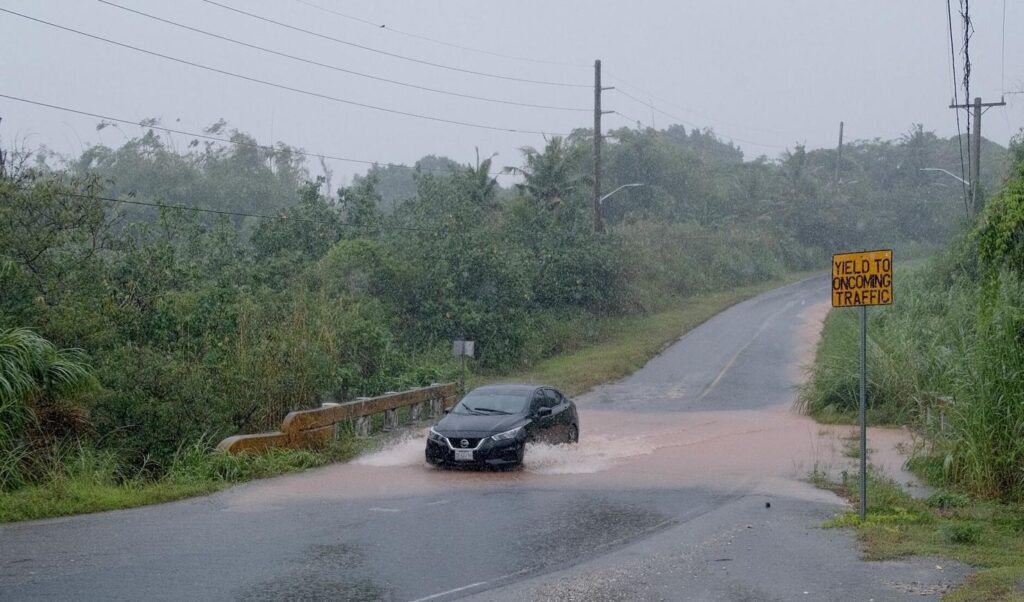
Guam is expected to receive between 10 to 20 or more inches of rain during the supertyphoon’s passage. Landslides, overflowing streams and rivers, could lead to flooding across the island, especially in central and southern villages, NWS advised.
“Electricity and water may be unavailable for days and perhaps weeks after the storm passes. Most trees will be snapped or uprooted. Fallen trees may cut off residential areas for days to weeks,” the weather service stated.

A vehicle passes over a flooded area of Cross Island Road ahead of the approaching Supertyphoon Mawar on Tuesday. Areas of the island that are hit by the cyclone’s eye could experience gust of up to 190 mph Wednesday.