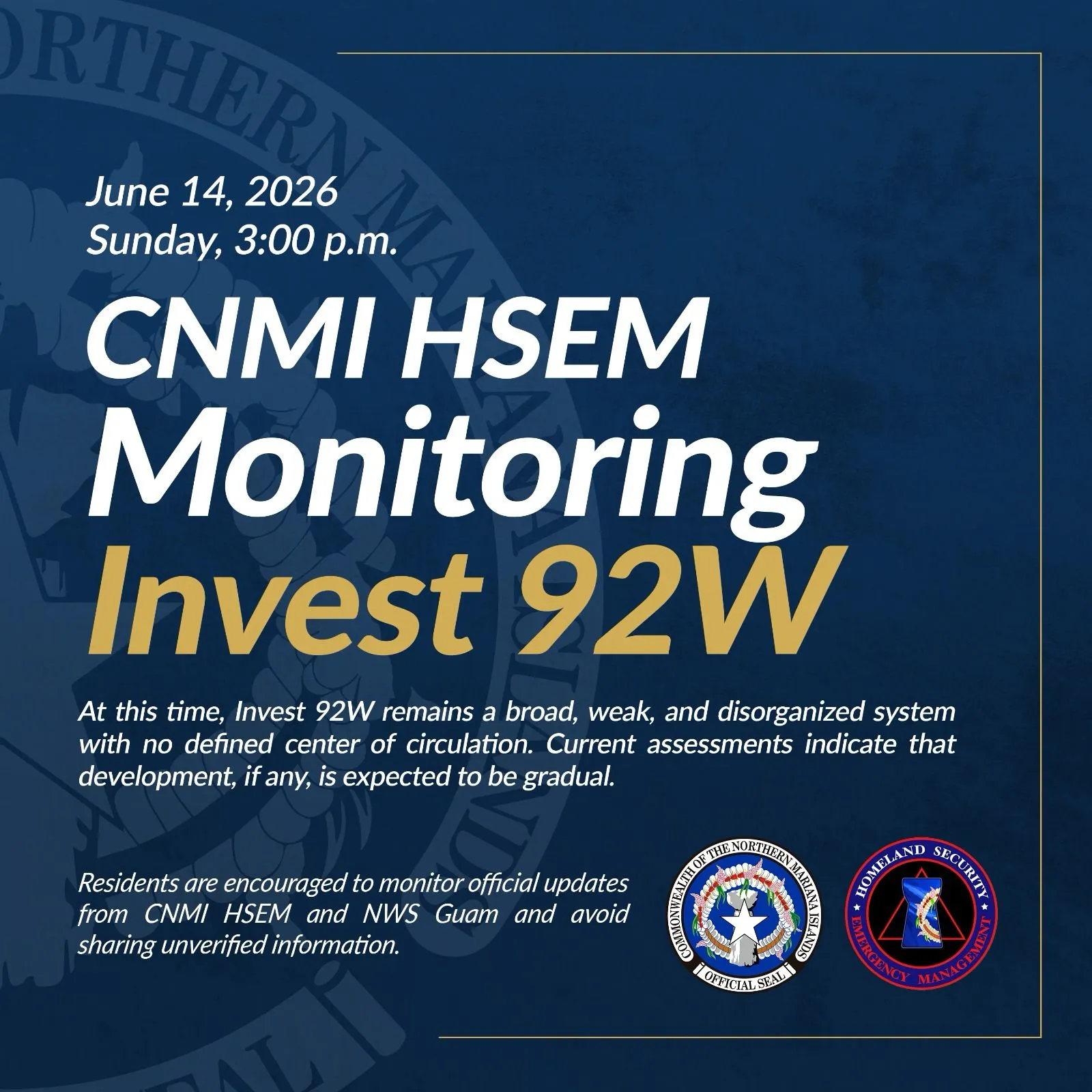


(CNMI Homeland Security and Emergency Management Agency) — The tropical storm watch for Rota has been canceled.
This means that damaging winds are no longer expected, although residents should maintain precautionary measures for strong gusty winds and heavy rain showers associated with feeder band activity.
As of 7 p.m. Monday, Tropical Depression 16W was
about 255 miles east-southeast of Tinian;
about 250 miles east-southeast of Saipan;
about 265 miles east of Rota; and
about 290 miles east of Guam.
Maximum sustained winds: 25 mph.
Present movement: west, 280 degrees at 18 mph.
Tropical Depression 16W is expected to maintain this general course with a slight decrease in forward speed over the next 24 hours.
Maximum sustained winds have weakened even further and are now down to 25 mph.
16W is expected to maintain this weakened state until it has passed well west of the Marianas and to the Philippine Sea where there may be potential for some eventual strengthening.
Because 16W no longer poses a threat, Gov. Ralph DLG Torres issued the following condition as of 8:30 p.m., Monday:
All clear on Rota.
The CNMI Emergency Operations Center State Warning Point will continue to monitor the movement of Tropical Depression 16W, and will issue bulletins as they become available.
Keep a close watch on updates to weather forecasts and stay informed on the latest statements and advisories which will be available through local media sources and NOAA weather radio broadcast via phone at 211. You may also call CNMI EOC State Warning Point at 237-8000 or 664-8000. Those in the Northern Islands may contact CNMI EOC State Warning Point at high frequency single side band radio on frequency 5.205.0.
