


(CNMI Homeland Security and Emergency Management) — Based on the information received from the National Weather Service in Tiyan, Guam and compiled at the CNMI Emergency Operations Center State Warning Point:
A developing tropical system and trailing monsoon surge will impact the Marianas over the coming days.
Heavy rain, strong winds, and choppy seas and surf possible.
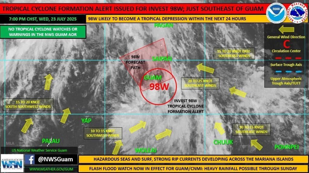
The Joint Typhoon Warning Center has issued a tropical cyclone formation alert for Invest 98w, centered near 12.9n, 145.0e. 98w is expected to develop into a significant tropical cyclone (tropical depression) within 24 hours.
As 98w pushes across the southern Marianas and then off to the north and west of the islands over the next couple of days, a strong southwest monsoon surge is expected to develop across the Marianas in its wake.
Heavy rainfall and breezy to windy conditions are expected across the Marianas through Saturday with the passage of 98w and the ensuing monsoon surge.
Rainfall amounts of 6 to 12 inches are possible across the region through Saturday night, with locally higher amounts also possible. With the expected prolonged and heavy rainfall over the coming days, there will be a growing concern for mudslides potential. A flood watch is in effect through Saturday night.
Winds and seas will become hazardous to small craft, with winds 20 to 30 kt and gusts to 40 kt and seas 8 to 12 feet anticipated by Thursday night. A small craft advisory is in currently in effect for Tinian and Saipan, and will begin for Guam and Rota beginning Thursday morning, continuing through Saturday night.
Surf is expected to rise along east and south facing reefs first beginning Thursday, then transition to south and west facing reefs as 98w pushes to the northwest and the southwesterly monsoon intensifies in its wake. This will cause the surf and risk of rip currents to rise along south and west facing reefs as surf will exceed the nine-foot threshold. Surf and rip risk look to remain hazardous through much of the weekend.
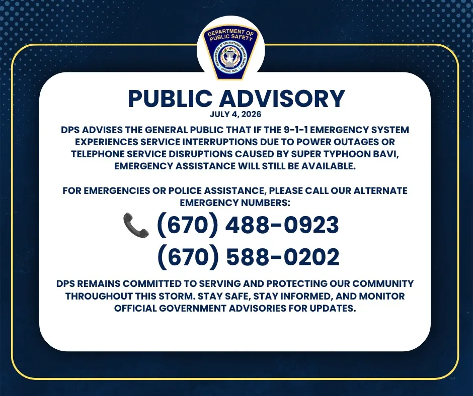
Acting Gov. David M. Apatang is advising residents of Saipan, Tinian and Rota to stay informed on the latest forecasts and statements which will be available through local media sources and NOAA weather radio broadcast on 162.5 megahertz, or call CNMI EOC State Warning Point at (670) 237-8000 or (670) 664-8000. Those in the Northern Islands can contact CNMI EOC State Warning Point at high frequency single side band radio on frequency 5.205.0.