


By Bryan Manabat
[email protected]
Variety News Staff
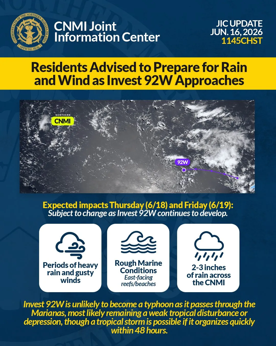
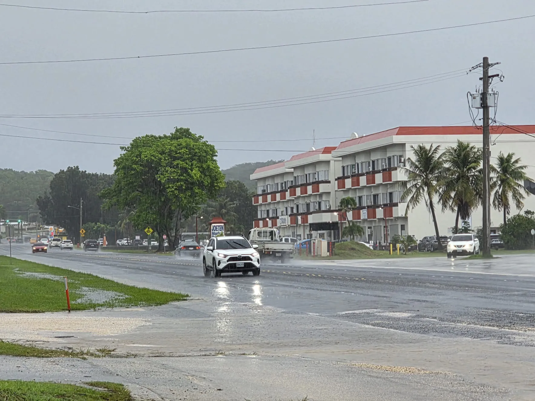
BREEZY conditions, scattered showers, and isolated thunderstorms are expected to continue Tuesday across Saipan and Tinian as a lingering shear line keeps the region unsettled, while a small craft advisory remains in effect due to hazardous seas and strong northeasterly winds.
Forecasters say Tuesday will bring mostly cloudy skies with scattered showers throughout the day and night, along with northeast winds of 15 to 25 mph. Highs are expected near 86, with lows around 76. The National Weather Service in Guam warns that locally heavy showers remain possible as the system slowly shifts south.
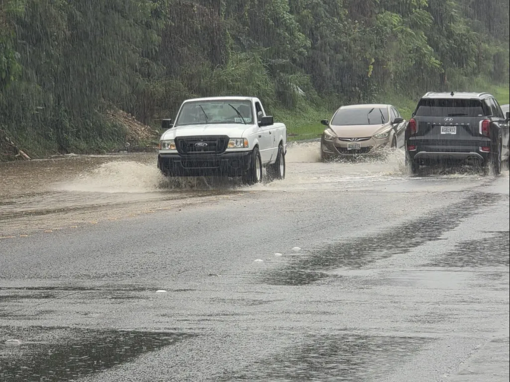
The rough weather follows a stormy start to the week, including a flood advisory early Monday morning for Saipan and Tinian after heavy overnight rainfall triggered urban and small-stream flooding. Rain gauge reports showed 1 to 2 inches had already fallen by dawn, with an additional 1 to 3 inches expected. Flooding was reported or possible in Garapan, Dandan, Chinatown, Tanapag, As Mahetog, Koblerville, San Jose on Tinian, Chalan Kanoa I–IV, San Antonio, San Roque, Kagman, Gualo Rai, Afetnas, Chalan Piao, Fananganan, and Chalan Laulau.
The CNMI Emergency Operations Center–State Warning Point said the National Weather Service also issued a high surf advisory and a high risk of rip currents for west- and north-facing reefs through 6 p.m. Monday, driven by a significant pulse of northerly swell. Seas of 8 to 10 feet created dangerous conditions for swimmers and small craft.
Monday’s conditions
Monday brought widespread locally heavy showers and isolated thunderstorms, with northeast winds of 20 to 25 mph and highs near 84. Rain chances reached 80 percent. Scattered showers and isolated thunderstorms continued into the night, with breezy winds of 15 to 25 mph and lows around 76.
Marine conditions remain hazardous
A small craft advisory remains in effect for Saipan and Tinian coastal waters through early Tuesday morning. Combined seas of 8 to 10 feet, driven by long-period northerly swell and elevated wind waves, continue to pose risks to small vessels. Strong to near-gale-force gusts are possible through midweek, and visibility may be reduced in heavy showers.
Seas are expected to gradually fall below hazardous levels later in the week.
Rota, too
Rota is experiencing similar conditions, with numerous showers Monday and a high surf advisory in effect. Winds of 10 to 15 mph, with gusts near 25 mph around heavier showers, pushed seas to between 7 and 9 feet. A small craft advisory remains in effect through late Monday afternoon.
Emergency officials advise residents to avoid flooded roadways and heed all weather advisories.
Bryan Manabat was a liberal arts student of Northern Marianas College where he also studied criminal justice. He is the recipient of the NMI Humanities Award as an Outstanding Teacher (Non-Classroom) in 2013, and has worked for the CNMI Motheread/Fatheread Literacy Program as lead facilitator.