

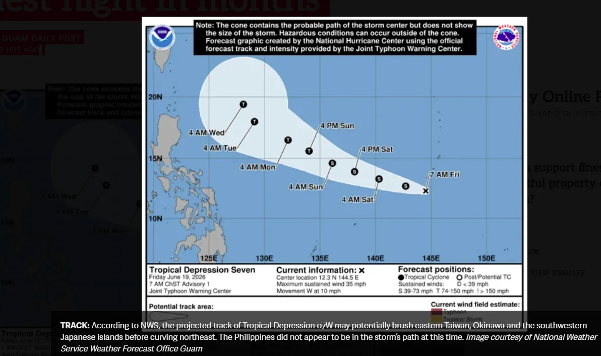


HAGÅTÑA (The Guam Daily Post) — A direct hit from the still-intensifying Supertyphoon Mawar would be the worst in decades, possibly surpassing the devastation of Supertyphoon Pongsona in 2002, according to forecasters with the National Weather Service.
“We are looking at the high potential for a direct hit and passage of a supertyphoon on Guam. This would be the first time in many years. This will be a benchmark storm that many folks on this island have not experienced,” said Landon Aydlett, chief meteorologist for the local office of NWS.
The intensity of Mawar and the storm’s likelihood of hitting Guam directly have grown through Tuesday. Conditions will steadily deteriorate over the next 18 hours.
The landscape of the island may be “radically altered” come Thursday morning, Landon Aydlett said during a NWS Facebook livestream Tuesday night.
“This is going to be a significant event, one that will be remembered for decades.”
Peak wind conditions are expected to begin around 9:10 a.m. on Wednesday morning, he said.
Around midday on Wednesday, maximum winds are expected to reach 130 to 155 miles per hour, with gusts up to 190 miles per hour, said Brandon Aydlett, NWS science and operations officer.
“Conditions are going to steadily improve through Wednesday afternoon (and) Wednesday evening, but we’re not going to see wind speeds drop below typhoon conditions until sometime around the sunset,” Brandon Aydlett said.
“We’re still going to have damaging winds through the night and (into) early Thursday morning,” with tropical storm-force winds lasting potentially up to 36 hours.
Anyone who is not sheltered in a reinforced concrete structure is taking a substantial risk, he said. The storm is “potentially catastrophic.”
“You need to go ahead and take the next couple of hours if you are not in a fully concrete structure. Find one right now. Friends, family (and) government shelters, there’s a lot of schools that are open.”
Buildings and homes made of light material could be disintegrated with Category 4-force winds, which can reach gusts of up to 197 miles per hour, according to the Weather Service. Well-built wooden and metal structures face severe damage, as do non-concrete roofs, and non-reinforced roof structures. Window frames and doors can completely fail.
Rainfall of 15 inches will not be uncommon throughout the island, and up to 20 inches of rainfall will be likely in areas close to the eye wall of Mawar.
NWS officials will be monitoring conditions for the next 48 hours. Dial 211 for the National Oceanic and Atmospheric Administration Weather Radio, 24 hours a day.
<p class=”p1″><span class=”s1″>“We’re still going to have damaging winds through the night and (into) early Thursday morning,” with tropical storm-force winds lasting potentially up to 36 hours, Brandon Aydlett said.</span>
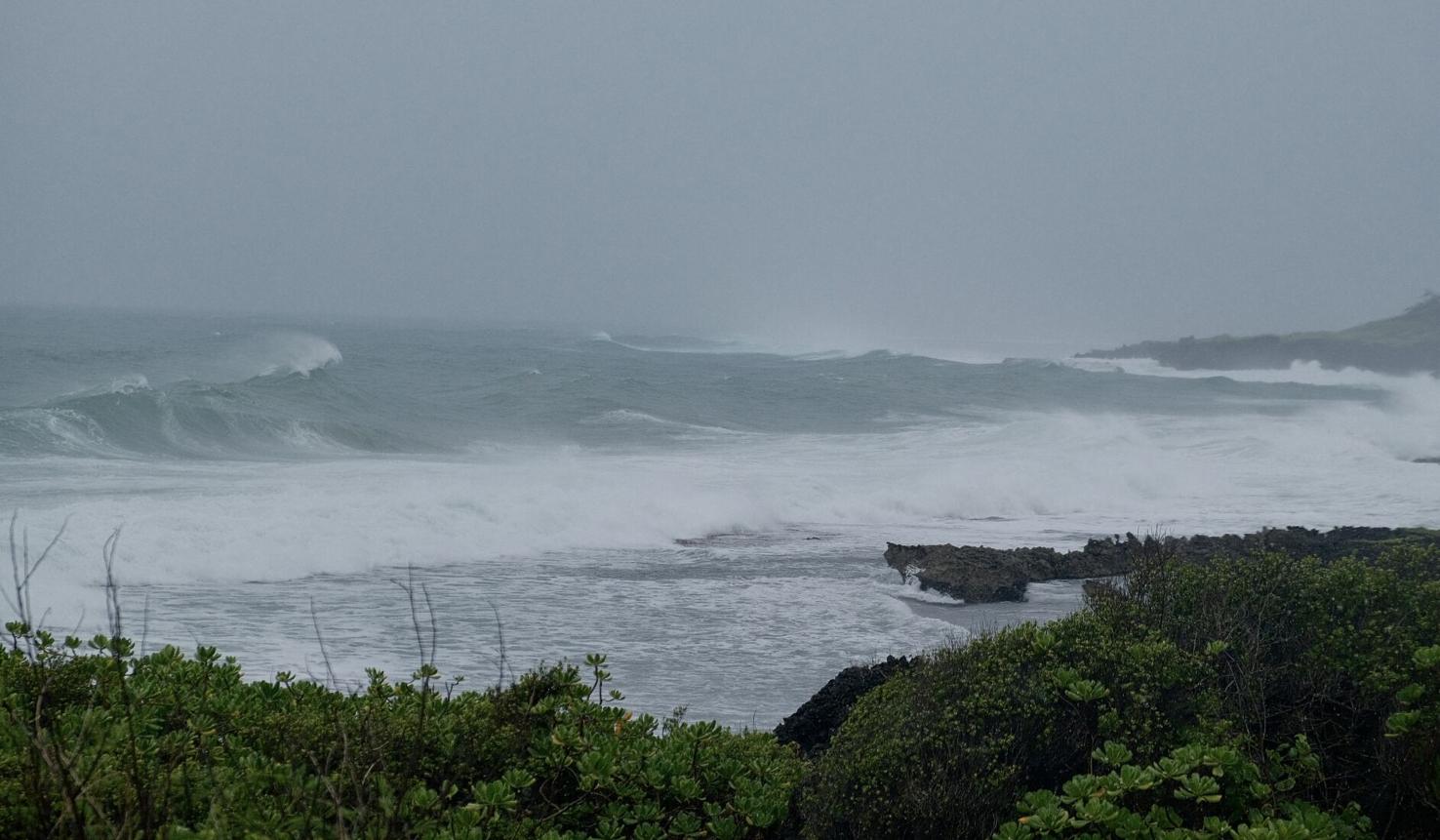
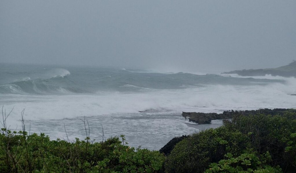
Large waves break near Inalåhan Pool ahead of the approaching Supertyphoon Mawar Tuesday.