


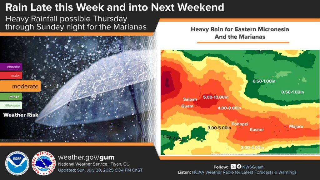

(CNMI Homeland Security and Emergency Management) — A tropical disturbance could bring heavy rain to the Marianas from Thursday evening through Sunday.
The latest model guidance shows a surface trough within Pohnpei that is expected to move northwest over the next couple of days. This trough is expected to develop into a weak circulation Thursday or Friday near the Marianas. Models differ on location and strength of this circulation; however, they do agree that heavy rainfall is likely as early as Thursday, continuing through the weekend.
There is a potential for the CNMI to see rainfall amounts of 5 to 10 inches by Sunday, though locally heavier amounts are possible. This rainfall is expected to produce minor flooding across the islands, with flash flooding possible in the areas of heavier rainfall.
Residents of the Marianas need to closely monitor this developing situation as watches, advisories and warnings could be issued later.
If living near streams and rivers, prepare to move items away from stream and river banks. Make sure storm drains nearby are not clogged, especially if living in low-lying areas.
Gov. Arnold I. Palacios is advising the general public that localized flooding will be possible in low-lying and poor drainage areas. Ensure nearby storm drains are not clogged, especially for low-lying or flood-prone areas.