


(CNMI HSEM) — Based on information received from the National Weather Service-Guam and compiled at the CNMI Emergency Operations Center-State Warning Point:
Very dangerous Category 4 Super Typhoon Bavi moving west-northwest toward the Marianas.
A tropical storm warning is now in effect for Alamagan. Tropical storm force winds of 39 mph or more are expected in around 24 hours.
A typhoon warning remains in effect for Guam, Rota, Tinian, and Saipan, and surrounding coastal waters. Typhoon force winds of 74 mph or more are expected, with the onset of damaging winds expected within 24 hours.
A tropical storm watch remains in effect for Pagan and Agrihan tropical storm force winds of 39 mph or more are possible, and could begin within 48 hours.
Summary of 7:00 am ChST information
Location…12.9N 149.2E
About 280 miles east-southeast of Saipan
About 280 miles east-southeast of Rota
About 280 miles east-southeast of Tinian
About 300 miles east of Guam
About 395 miles southeast of Alamagan
About 425 miles south-southeast of Pagan
About 465 miles south-southeast of Agrihan
Maximum sustained winds…155 mph
Present movement…west…280 degrees at 7 mph
At 7:00 am ChST, the center of Super Typhoon Bavi was located near latitude 12.9 degrees north and longitude 149.2 degrees east. Bavi is moving west at 7 mph. It is expected to make a slight turn toward the west-northwest with an increase in forward speed through Monday. This general forecast track will take Bavi near Rota on Monday morning.
Maximum sustained winds have decreased slightly to 155 mph. Bavi is forecast to increase slightly to 160 mph tonight and maintain this intensity through Monday.
Typhoon force winds extend outward from the center up to 45 miles. Tropical storm force winds extend outward from the center up to 185 miles.
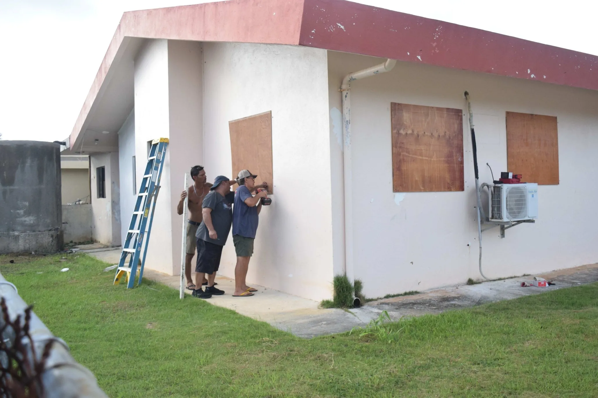
Because of the anticipated threat of Super Typhoon Bavi (09w), Governor David M. Apatang has issued the following conditions as of 8:00 am maintaining
• Typhoon Condition II: Saipan, Tinian, and Rota
* Typhoon Condition II means that typhoon force winds of 74 mph or more are expected, with the onset of damaging winds expected within 24 hours or less.
Maintaining:
• Tropical Storm Condition III: Pagan & Agrihan
* Tropical Storm Condition III means that tropical storm conditions, including winds of 39 to 73 mph, are possible within 48 hours.
Upgraded:
• Tropical Storm Condition II: Alamagan
• Tropical Storm Condition II means that tropical storm force winds of 39 mph or more are expected within 24 hours.
The CNMI Emergency Operations Center State Warning Point will be monitoring the movement of Super Typhoon Bavi (09w) and will be issuing out bulletins as they become available. Keep a close watch on updates to weather forecasts and stay informed on the latest statements and advisories which will be available through local media sources and NOAA weather radio broadcast via phone at 211, or call CNMI EOC State Warning Point at (670) 237-8000 or (670) 664-8000, and for the northern islands to contact CNMI EOC State Warning Point at high frequency single side band radio on frequency 5.205.0.
An intermediate bulletin will be issued at 11:00 am ChST, followed by the next scheduled bulletin at 2:00 pm.