


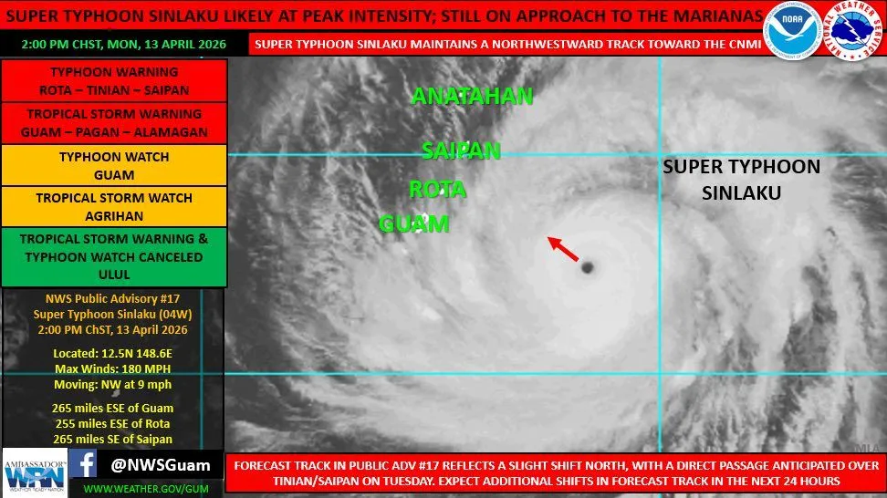
(National Weather Service) — Super Typhoon Sinlaku remains a powerful system with maximum sustained winds of 180 mph.
At 1 p.m., Sinlaku was located 265 miles east-southeast of Guam near 12.5N 148.6E. It was moving northwest at 9 mph. The current track still reflects an anticipated passage over, or near, Saipan and Tinian around Tuesday afternoon/evening, still as a powerful Category-4 typhoon.
Preparedness actions should be complete, with residents across Guam and the CNMI set to shelter in place by sunset tonight, as damaging tropical storm force winds set in.
Heavy rainbands are beginning to shift westward into the Marianas. The relatively fair weather this morning will soon end as conditions deteriorate in the coming hours. Heavy rainbands will bring torrential rainfall, the risk of flash flooding and strong gusty winds, that will only increase overnight, particularly across the CNMI.
Winds are increasing across the region, with sustained winds at the Guam Airport of 20 to 25 mph and gusts of 30 to 40 mph. Winds at the Saipan Airport are currently sustained around 25 to 30 mph with gusts of 40 to 45 mph. Winds will continue to increase.
Be ready for the onset of tropical storm force conditions across the region, with winds becoming typhoon force across the CNMI early on Tuesday.
Keep up to date with the latest forecasts and conditions at weather.gov/gum/.