


THE CNMI Joint Information Center advises the public to remain alert and continue any preparedness actions as Invest 92W moves west-northwest toward the Mariana Islands.
According to the National Weather Service Guam, Invest 92W was upgraded early Wednesday from a Low to a Medium chance of development into a tropical cyclone. This means that 92W could become a tropical depression beyond 24 hours. Slow but steady organization is expected to continue as 92W approaches.
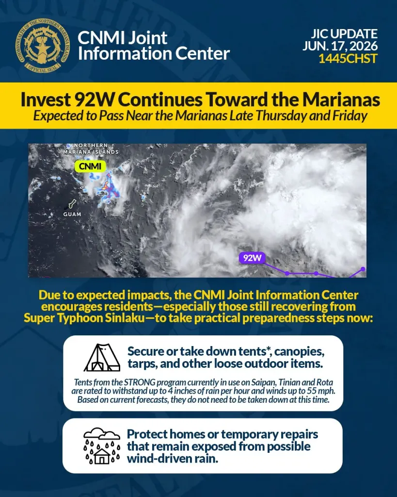
Current forecasts show Invest 92W passing near or through the Marianas between Thursday afternoon and Friday night, with the closest point of approach potentially occurring early Friday morning. Residents should expect showers, thunderstorms and gusty winds, with the potential for locally heavy rainfall.
Due to expected impacts, the CNMI Joint Information Center encourages residents — especially those still recovering from Super Typhoon Sinlaku — to take practical preparedness steps now:
• Secure or take down tents, canopies, tarps, and other loose outdoor items.
STRONG tents currently in use on Saipan, Tinian and Rota are rated to withstand up to 4 inches of rain per hour and winds up to 55 mph. Based on current forecasts, they do not need to be taken down at this time.
• Protect homes or temporary repairs that remain exposed from possible wind-driven rain.
If conditions change, additional guidance will be issued.
Weather synopsis
As of 6 a.m. Wednesday, June 17, the system was centered near 11.1 degrees north latitude and 152.8 degrees east longitude.
It was about 494 nautical miles east-southeast of Guam, and was moving west-northwest at 12 mph.
The system is likely to become a tropical depression, possibly before or during its passage through the Marianas. A tropical storm remains a lower-end possibility if strengthening occurs faster than expected.
For the CNMI, anticipated rainfall totals are 2 to 4 inches, with locally higher amounts possible. Sustained winds around 25 knots are possible, especially on Saipan and Tinian, with a slight chance of gusts near 34 knots.
Sustained damaging winds of 39 mph (34 knots) are not expected at this time, and no tropical storm watches or warnings are in effect.
The National Weather Service Guam notes that the risk of rapid intensification is low, and a typhoon or severe tropical storm is not expected. However, residents should continue to monitor conditions, as changes in track or strength over the next 12 to 36 hours could affect local impacts and response timelines.
For official updates, monitor announcements from the CNMI Joint Information Center. For the latest information, follow the CNMI Homeland Security and Emergency Management Office and CNMI Joint Information Center on Facebook (@cnmigovernor) and Instagram (@governorcnmi), as well as the National Weather Service Guam on Facebook (@NWSGuam) or at weather.gov/gum/.