


By Walter Ulloa
For Variety
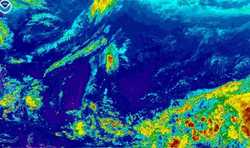
HAGÅTÑA (The Guam Daily Post) — A week after Super Typhoon Sinlaku battered the Commonwealth of the Northern Mariana Islands, federal forecasters are watching a potential tropical system taking shape in eastern Micronesia that could affect the Marianas as early as next week.
The National Weather Service Weather Forecast Office Guam and Guam Homeland Security/Office of Civil Defense jointly issued an advisory Monday, noting model data showing a possible tropical circulation developing in the May 3-6 timeframe that could pass near or south of the Marianas.
Landon Aydlett, warning coordination meteorologist at NWS Guam, told The Guam Daily Post the forecast picture has shifted since last week, when models were split between showing a tropical system over the islands and showing nothing at all.
“We’re starting to see more of the forecast models showing something emanating out of Micronesia,” Aydlett said. “The likelihood of a tropical system in the region, yeah, that’s increasing. But now the question is where, when, and how strong.”
The Joint Typhoon Warning Center has opened an investigative area, designated 91W, on a weak circulation in the central Pacific. It is not yet listed on public-facing web pages because it is rated as a sub-low, meaning development is not expected within the next several days.
“This is very early in the process,” Aydlett said. “We’re going to be tracking that weak disturbance and see how it evolves. Will this be the disturbance to develop? That’s not yet clear.”
With seven to eight days still in the forecast window, Aydlett said there are far too many variables to predict whether the system will threaten Guam or the CNMI at all. That uncertainty, he said, is precisely why NWS Guam felt it necessary to speak up now.
Social media speculation and widely available long-range forecast models have already been driving anxiety across Guam and the CNMI, and Aydlett said the official weather community needed to step into that conversation with a clear, measured voice.
“Typically, we probably wouldn’t be openly communicating to the public this far out with an early emerging disturbance,” he said. “But with the propagation of social media and a number of forecast models that are showing these long-range scenarios that put people into panic, we do have to get that government weather voice into the conversation.”
His message to residents is straightforward: the rumors circulating online are outpacing what the science actually supports right now, and panic serves no one.
For the immediate future, Guam and the region can expect calm, favorable conditions through much of the week. Breezy trade winds through midweek may create hazardous surf along east- and north-facing beaches and reefs, so water safety is advised. Otherwise, Aydlett said conditions will be good into the weekend.
That window, he added, is the right time to quietly and calmly prepare, without rushing to stores or hoarding supplies. He pointed to the strain Sinlaku placed on CNMI communities where many residents were not ready to sustain themselves.
“Make sure you can be self-sufficient for several days because the folks in the emergency management community, they’re also weathering the storm, and they have to leave their families at home,” he said.
Aydlett acknowledged he is still restocking his own refrigerator after Sinlaku and may not get fully stocked before next week. He said that is the right mindset for everyone right now.
“Keep the potential, the possibility of a tropical cyclone, in the back of your mind,” he said.
His bottom line: follow the official forecast, not the rumors.
“Don’t worry. Don’t be anxious. But stay tuned and be prepared,” Aydlett said. “We may be dealing with something on our shores next week. We may not. It’s just too early to say.”
For updates, visit weather.gov/gum or the NWS Guam and GHS/OCD Facebook pages.