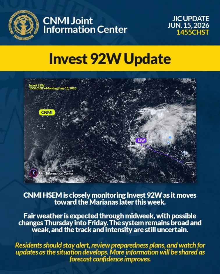


HAGÅTÑA (The Guam Daily Post) — The wind field of Supertyphoon Mawar is expanding as it meanders away from Guam, exposing the island to continued damaging winds up until about midday, Landon Aydlett, chief meteorologist of the local office for the National National Weather Service said during an 8 a.m. broadcast.
Small debris like metal signs can continue to pose a hazard and trees are still in danger of falling. “Strong gusts, those are going to be a surprise, those are the ones that are going to hinder services across the island,” NWS Science and Operations Officer Brandon Aydlett said. Restoration of power and telecommunication services, is “going to take some time, especially for those more isolated areas of Guam,” he said.Exposed, higher terrain of the island is likely to experience higher winds, according to weather service reports.
Showers are decreasing across the island but minor flash flooding remains concern and a flood watch remains in effect for Guam until late Thursday morning. Guam remains in Condition of Readiness 1 through Thursday morning, the Joint Information Center stated previously. The latest Weather Service report puts Mawar at 65 miles north-northwest of Guam as of 7:38 a.m. and moving northwest at 8 miles per hour.
The Weather Service is seeking to confirm reports that the eye of Mawar may have passed over far northern Guam. Previous assessments placed the eye of the storm moving just north of the island through the Rota channel. “It was really a thrashing that was delivered to northern Guam during that overnight passage,” Landon Aydlett said. The local NWS office, located in Tiyan, shut down operations as of 9 a.m., and now the NWS out of Hawaii has taken over updates.
“Strong gusts, those are going to be a surprise, those are the ones that are going to hinder services across the island,” NWS Science and Operations Officer Brandon Aydlett said.
A visual representation of Supertyphoon Mawar as it exits the Marianas is shown in this National Weather Service graphic.